The short version
- The best contribution explains one bounded question for an informed reader: what was observed, how it was measured, what interpretation is reasonable and what remains unknown.
- High-value topics include background versus anomaly, sampling scale, QA/QC, detection limits, field naming, weathering, source rock versus product and how to read public map layers without turning them into reserve claims.
- A 1,200–1,800 word field note is usually more useful than a broad essay. The editor provides a source pack and structure; the author approves technical meaning; a separate reviewer checks higher-risk material.
- Credentials, affiliations, project or financial conflicts and material AI assistance are disclosed. Sales language and project promotion are removed.
- Contributors can pitch, co-write, provide a source note or review a draft. A complete manuscript is not required.
The missing layer between a public dataset and a confident conclusion
A public register can preserve a site name, location, commodity and source. A geological map can show a unit. A geochemical atlas can show a sample and an analytical value. None of those facts automatically establishes a mine boundary, reserve, product specification, cause, environmental condition or investment case. The most valuable professional contribution explains that gap without making the subject inaccessible.
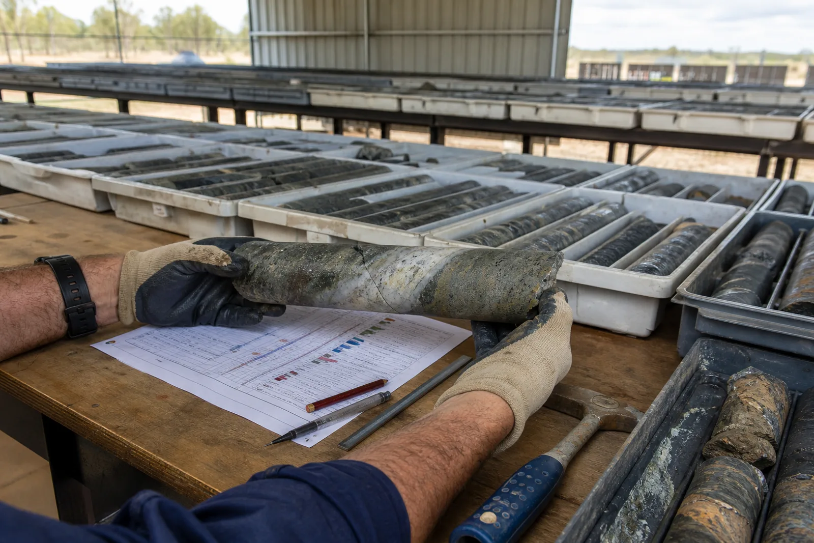
A geologist can explain field terminology, scale, weathering, structural context and why a mapped unit varies. An engineering geologist can connect material description to defects, moisture and behaviour without certifying a product. A geochemist can explain sample media, background, anomaly, detection limits and QA/QC. A surveyor or GIS specialist can explain representative points, centroids and coordinate uncertainty. These notes help readers ask better questions of the primary source.
Geoscience Australia provides national data and publication entry points, including the National Geochemical Survey Atlas. The atlas publishes results for 68 elements across 1,315 sample sites and 1,186 catchments. Those numbers make a powerful national overview; they also demonstrate why scale and method belong in the article. A sample tied to a large catchment cannot be promoted as a project-scale discovery.[7][8]
Four contribution formats that do not require a finished paper
A source note is 300–800 words around one map, sample method, field photograph or terminology correction. A field note is 1,200–1,800 words answering one practical question. A data explainer documents dataset version, method, limitations and a reproducible reading sequence. A technical review checks an editor-prepared draft and records what changed. An author can begin in any one of these roles.
The model follows established professional practice without pretending to be a scholarly journal. AusIMM’s contributor guide says Bulletin articles range from 500 to 3,000 words, use accessible professional language, welcome informative graphs or tables and should not read as sales copy. It explicitly says the Bulletin is not peer reviewed. Mines & Quarries applies the same clarity about its format and adds visible sources, conflicts, last-review date and version history.[1][2]
Mining-history work can require a different depth. The Australasian Mining History Association publishes refereed and non-refereed sections and provides contributor and reviewer guidance. A public field note here can point to that specialist pathway when a subject deserves a scholarly paper. Publication on Mines & Quarries should never be labelled peer reviewed merely because a professional checked it.[3]
Ten geology and engineering-geology briefs ready for an author
The first group is vocabulary with consequences: mudstone, siltstone and shale in the field; basalt, scoria and tuff; granite as a geological term and a trade name; hornfels near an intrusion; weathered versus fresh rock; and “hard rock” as an operational description. Each note should show the observable basis, the scale, competing terms and when laboratory or petrographic work is required.
The second group is map literacy: how to read GeoVic without overclaiming; why a mapped unit is not a product; how geological contacts and faults change with scale; and how a representative site point differs from a working, deposit, licence or land parcel. A strong article uses one public, non-confidential example and follows it from metadata to cautious conclusion.
The third group connects geology to the supply chain without promising performance: source rock versus saleable product; weathering and durability questions; joints and block size; moisture and slaking in sedimentary material; petrography as one part of assessment; and why crushing, screening or washing can change the commercial description. Product compliance remains a testing and specification question.
Ten geochemistry briefs that prevent the most common reading errors
Begin with background versus anomaly. Explain that background is a distribution shaped by geology, regolith, sampling media, method and scale—not zero. Show why a high value can be real but not project-scale evidence, and why a low value can reflect method, media or dilution. Use a public dataset and avoid live project promotion.
Then cover the sampling chain: target population, sample support, catchment, site selection, preparation, digestion, instrument, detection limit and units. Explain blanks, certified reference materials, field duplicates, laboratory duplicates and repeats. Each control answers a different question; the presence of a QA/QC table does not automatically prove the program is fit for every interpretation.
Other ready briefs include soil versus stream sediment versus rock chip; compositing and loss of local variation; censored values below detection; old assay units and method changes; data normalisation; maps that imply false boundaries; portable instrument screening versus laboratory analysis; and the difference between exploration geochemistry and environmental assessment. Higher-risk environmental or health interpretations require specialist review and may be held.
How to turn a city or council area into a useful technical article
Start with one question, not “the geology of the shire”. Examples are: why basalt and scoria labels recur across the western plains; what sedimentary-material terms appear in Gippsland authority records; how mapped granite relates to historic building-stone use; or how water and alluvium shaped early workings around Beechworth. Define the geographic boundary and source scale.
Use a three-layer structure. Layer one reports what the government dataset actually says. Layer two explains mapped geology, methods and limits. Layer three adds local records—heritage studies, maps, transport, photographs or family evidence. Keep the authorship visible: council or archive staff may supply a source; the geologist interprets geology; the editor connects the public record. No one is made to endorse the other layer.
End with a field-question list rather than a verdict. Which material name needs petrographic confirmation? Which authority description is broad? Which map is too small scale for a property inference? Which council collection may explain a historical quarry name? This creates precise invitations for a second contributor.
Credentials and conflicts build trust only when they are specific
A profile should state the relevant discipline, experience and affiliations without turning memberships into endorsement. AIG, GSA Victoria, AusIMM and the Australian Geoscience Council provide professional networks and public technical activity, but a contributor’s participation does not make the article an institutional position. Organisation names and post-nominals are verified before publication.[4][5][6]
Conflicts include employment, consulting clients, asset ownership, shareholdings, supplier relationships, litigation, advocacy roles and sponsorship relevant to the subject. A conflict does not always prevent publication. It may require disclosure, narrower scope, independent review or refusal. A company case study should teach a transferable method rather than operate as a disguised advertisement.
Material AI assistance is disclosed to the editor. It cannot be used to invent field experience, citations, data or quotations. Every source is opened and checked by a person. The contributor remains responsible for the submitted interpretation; the editor remains responsible for publication. Generated historic-looking imagery is not used as evidence.
How the contributor network grows without harvesting people
Publish narrow open briefs through opt-in channels: professional newsletters, branch events, university groups, mining-history networks, council libraries and local societies. Ask an association to circulate a neutral call; do not request its member list. Invite event speakers through a public professional contact only when the brief directly matches their work.
Use a referral triangle after every accepted piece: ask for one person who can challenge the interpretation, one archive or dataset the article missed and one practitioner from another discipline. A geochemist may refer a GIS specialist; a council archivist may identify a family society; a former operator may know the engineering geologist who can explain the material. The referral is an introduction request, not permission to add someone to marketing.
Recognition should reward evidence, not agreement. Offer a verified profile, reviewer credit, source-pack access, change alerts and a visible version note. Where a commissioned budget exists, agree the honorarium before drafting. Do not rank contributors by volume, sell favourable treatment or promise commercial leads. The strongest network is the one whose members can see exactly what their contribution changed.
The five-sentence pitch
Sentence one names the question: “I can explain why background and anomaly cannot be separated from sampling scale.” Sentence two states the reader: “This is for people using public geochemical maps without specialist training.” Sentence three names the evidence: “I would use the National Geochemical Survey method and one non-project example.” Sentence four states relevant experience and conflicts. Sentence five proposes a format: field note, data explainer or review.
A contributor can also send a source note: one paragraph explaining a terminology issue and the primary reference. The editor may develop the article and return it for technical review. That route is often better for a busy professional than requesting an open-ended 2,000-word essay.
The first response should confirm scope, editorial control, credit, rights, disclosure, review and whether any payment exists. No manuscript should be commissioned through vague promises of exposure. No contributor should be asked to endorse the register, a supplier, asset or transaction.
Frequently asked questions
6 answersDo I need to submit a complete article?
No. You can pitch a question, provide a source note, co-write from an editor-prepared outline or review a draft.
What article length is preferred?
A focused field note is usually 1,200–1,800 words. Short source notes and longer deep reports are used when the question requires them.
Are Mines & Quarries articles peer reviewed?
No, unless a page explicitly describes a separate formal process. A technical reviewer is identified as expert review, not academic peer review.
Can I discuss my company or project?
Only where the example teaches a transferable method, public information is used, conflicts are disclosed and the article does not become sales or investment promotion.
What do geochemist contributors write about?
High-value topics include background versus anomaly, sampling support, media, QA/QC, detection limits, units, method changes and responsible interpretation of public maps.
Can reviewing a correction be the whole contribution?
Yes. A narrow, documented correction or technical review can be more valuable than a broad article and can lead to a later field note.
Sources and continuation points
- AusIMM Bulletin — Contributors Guide 2025Linked authority or collection reference; no additional data ingested · retrieved 2026-08-25
- AusIMM — About the BulletinLinked authority or collection reference; no additional data ingested · retrieved 2026-08-25
- Australasian Mining History Association — Journal and contributor informationLinked authority or collection reference; no additional data ingested · retrieved 2026-08-25
- Australian Institute of GeoscientistsLinked authority or collection reference; no additional data ingested · retrieved 2026-08-25
- Geological Society of Australia Victoria — About and activitiesLinked authority or collection reference; no additional data ingested · retrieved 2026-08-25
- Australian Geoscience CouncilLinked authority or collection reference; no additional data ingested · retrieved 2026-08-25
- Geoscience Australia — Data and publicationsLinked authority or collection reference; no additional data ingested · retrieved 2026-08-25
- Geoscience Australia — National Geochemical Survey AtlasLinked authority or collection reference; no additional data ingested · retrieved 2026-08-25
Know something this report is missing?
Send a source-backed correction, material or geology lead, event, current-site evidence, photograph or family record. We preserve the evidence level and credit you—or keep you anonymous—after human review.