The short version
- Mudstone is a fine-grained sedimentary rock; it is not a synonym for every soft, layered quarry material.
- Victoria’s public work-authority dataset yields 123 current authorities in this register’s broader sedimentary-stone group, but only 0 explicitly use “mudstone”, 0 use “siltstone” and 2 use “shale” in the authority material field at review date.
- A current authority shows a regulatory record, not proof of present extraction, product specification, reserve, access or economic viability.
- Where the register uses a broad material label, the next evidence step is the authority record, GeoVic geology, planning material and a competent site investigation.
Start with the rock name, not the sales label
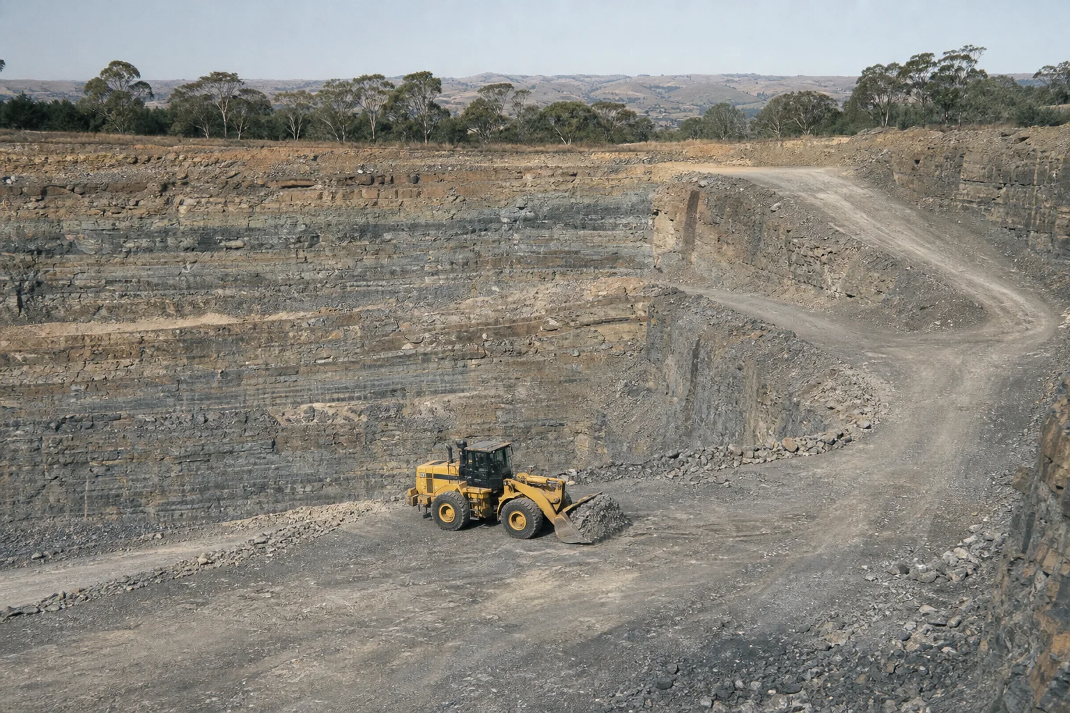
Mudstone, siltstone and shale belong to the sedimentary family, but they are not interchangeable labels. Mudstone is a very fine-grained clastic rock in which the grains are too small to distinguish readily in hand specimen. Siltstone is dominated by silt-sized particles. Shale is commonly recognised by its fissility: a tendency to split along closely spaced planes. Claystone is another fine-grained term, generally used where clay-sized material dominates. Weathering, cementation, bedding, mineralogy and moisture can make two rocks carrying the same field name behave very differently in a quarry or civil application.[10]
That distinction matters because a geological description, a work-authority commodity, a planning description and a marketed product answer different questions. A regulator may group stone for reporting. A quarry may sell products under performance-led names such as fill, pavement material or landscape stone. A geological map may name the host formation rather than the extracted horizon. None of those descriptions, standing alone, establishes that a particular material meets an engineering specification.[3][2]
Victoria’s stone-reporting guidance explicitly places sandstone, shale, siltstone, chert, mudstone and claystone within a sedimentary grouping. That is useful for classification, but it is also the reason a broad register category must not be silently narrowed to “mudstone”. On this site, the sedimentary-stone map is an orientation layer. An exact rock name is repeated only when it appears in the authority’s material field; otherwise the page retains the broader wording and explains the uncertainty.[3][1]
Why mudstone can be under-described in public search
People often search for a familiar rock word while public systems are organised around tenure, authority numbers, stratigraphic units or broad commodity classes. A quarry known locally for “mudstone” might be recorded as sedimentary stone, shale, sandstone, rubble, road material or another approved term. The reverse problem also occurs: a sedimentary-stone authority may cover a site where mudstone is not the principal saleable material. Keyword search therefore produces both gaps and false confidence.
The second difficulty is temporal. An authority can continue while extraction is intermittent, while a site is being rehabilitated, or while the commercial product mix changes. The Victorian dataset describes current extractive-industry tenements and includes active, proposal and application states. This publication only maps records that pass its current-authority gate, yet still refuses to convert that administrative status into an operating claim. Production, remaining material and sales availability require a more current and more specific source.[1][6]
The third difficulty is scale. State geological maps can identify formations containing fine-grained sedimentary rocks over large areas, but a map unit is not a quarry prospect. Overburden, weathering profile, structure, land use, access, groundwater, environmental values, planning controls and local demand all sit between a coloured polygon and a viable extractive site. Sparse public information is a reason to state the evidence boundary, not a licence to fill the gap with certainty.[4]
What the Victorian register does show: 123 current authorities
The map below filters the Victorian work-authority snapshot retrieved on 2026-08-24 to records classified by this project as sedimentary stone. It contains 123 current-authority records. The plotted point is derived from each public authority polygon for readable national mapping; it is not a surveyed entrance, extraction face or legal boundary. The complete authority polygon and current regulatory context remain with the Victorian source systems.[1]
Within those records, the authority material field explicitly names mudstone in 0, siltstone in 0, and shale in 2 at review date. Those counts are deliberately literal: they do not search business names, nearby geology or anecdotal product descriptions and then pretend the authority says more than it does. Some authority labels contain multiple materials, so the exact-name counts should not be added as though they were mutually exclusive.
The distribution is more useful as a research queue than as a market ranking. A cluster may reflect geology, metropolitan demand, transport economics, historical approvals, or simply the way source records have been classified. A quiet area may be constrained, under-mapped, supplied from another district or represented under different terms. Record density is not a measure of resource abundance and should not be used as a substitute for geological or planning analysis.
A defensible workflow for an uncertain location
Begin with the place and the question. “Is there mudstone near town?” could mean exposed geology, a current quarry product, a historical pit, a potential source for a civil specification, or material encountered in excavation. Write down which of those questions matters. Then search the Victorian Mining Register and current extractive-authority layer by locality, authority number and operator. Preserve the exact material wording, status and retrieval date.[7][1]
Next, use GeoVic to compare the authority or locality with geology, extractive occurrences, historical workings, available bore or report information, and the Strategic Extractive Resource Areas or Strategic Resource Initiative layers where relevant. Treat geological adjacency as a lead. Do not assign a formation or lithology to a quarry point merely because the symbols appear close at a small map scale. Open the underlying report and check scale, mapping date and certainty.[4][5]
For product or engineering questions, ask for a current product data sheet, source description and test results tied to the supplied material. Terms such as select fill, pavement material and crushed rock are controlled by use and performance requirements, not by visual resemblance alone. Variability within a sedimentary sequence can be material: thin sandstone beds, weathered zones, clay seams and moisture sensitivity may change excavation and processing behaviour.
For a proposed new source, the research becomes a planning, land, environment, community, transport and work-authority exercise as well as a geological one. Victoria identifies strategic extractive-resource planning areas because construction materials are bulky and transport-sensitive, but strategic mapping does not itself grant an approval. Early discussion should involve appropriately qualified geological, planning, environmental and legal practitioners rather than a directory page.[5][6]
How the search changes in NSW, Queensland and South Australia
New South Wales publishes a Mineral Occurrences dataset with more than 31,000 occurrences across metallic minerals, industrial minerals and construction materials. Its scale makes it a powerful discovery source and a poor excuse for automatically publishing thousands of thin pages. The responsible approach is to ingest the licence and schema, classify terms transparently, suppress sensitive or incomplete records, and create regional research products only where the underlying evidence supports them.[8]
Queensland’s GeoResGlobe is a free spatial viewer with hundreds of resource, tenure, geology and infrastructure layers. It is best used as a research environment rather than cited as if every visible layer were one homogeneous dataset. Record the layer name and metadata, then follow it to the issuing dataset or report. A map screenshot without layer provenance is not a sufficient material claim.[9]
South Australia provides unusually useful public explanations of quarrying commodities, including siltstone and shale, alongside SARIG mapping and reports. Those resources help establish terminology and regional context. They do not establish that a Victorian authority contains the same lithology, nor that a South Australian occurrence is approved, accessible or commercially available. State systems must be read within their own legislative and data context.[10][11]
The words also carry a history of mapping and work
Material language changes with purpose and period. A nineteenth-century geological report, a municipal gravel-reserve file, a twentieth-century quarry return and a modern product sheet may describe the same district using different vocabularies. Historical writers could privilege the formation, the visible bed, the excavation method or the intended road use. Modern databases often compress that language to controlled categories. A good history article keeps the original term, explains it in its period and avoids retrofitting a modern commodity label without evidence.
Local names are worth recording because they can reconnect an authority with newspapers, rate books, planning files, photographs and family papers. They are not automatically geological names. The research trail should show who used the term, when and for what purpose. That approach makes oral history useful without forcing it to carry the burden of a laboratory result or statutory record.
This is also a practical reason to invite families, retired operators, drivers, geologists and council staff into the publication. They may remember spelling variants, ownership transitions, product names and access routes that help locate the right archive. Editors can then check those memories against dated public documents and publish the result with the uncertainty visible.
What local knowledge can add—and what evidence we ask for
Useful contributions include an authority or planning reference, a dated product sheet, a geological report, a correctly located historical photograph, an archived newspaper item, or first-hand context that can be clearly labelled and independently checked. A local term can be valuable even when it is not the formal rock name: it helps editors search the right historical and regulatory records.
A lead is published according to its evidence level. Confirmed source fields can correct the register. A documented but interpretive statement can appear with attribution and qualification. An unverified recollection remains a private research lead until corroborated. Contributors choose whether to be named, and retained documents are governed by consent and rights rather than a promise that every submission becomes public.
The contribution exchange rewards useful evidence with relevant research notes, change alerts or archive access where rights allow. It is not an investment scheme, a market for mineral rights or a guarantee of payment. The most useful first message is short: place, material term, approximate date, how you know, and what document or source could allow another person to verify it.
Register map
The map makes distribution legible without implying a tenure boundary. Hover a point to identify the record; use the working list for the full source page.
Working list
123 recordsThis reading list shows the first 30 alphabetically; the linked commodity or state index carries the remainder.
Frequently asked questions
6 answersIs mudstone the same as siltstone?
No. Both are fine-grained sedimentary rocks, but siltstone is dominated by silt-sized particles; mudstone is a broader very fine-grained rock term. Field naming can vary, so a site-specific description should come from competent logging or testing.
Does a Victorian current work authority mean the quarry is operating today?
No. It is a current regulatory record in the retrieved dataset, not independent proof of present extraction, product availability or production.
How many Victorian sedimentary-stone authorities are mapped here?
123 current-authority records at the 24 August 2026 review. Only 0 explicitly use the word mudstone in the authority material field.
Can the map be used to enter or visit a quarry?
No. Points are for register orientation, not access. Quarries are workplaces and may be on private land. Contact the relevant authority holder and follow all site, land-access and safety requirements.
How can I submit a suspected mudstone location?
Use the contribution form and choose material or geology lead. Provide the locality, the exact term used, approximate date and a source or document if available. It will remain a lead until reviewed.
Can mudstone be used as road base or fill?
Suitability depends on the material and the applicable project specification, including test results and variability. A rock name or quarry listing alone is not an engineering approval.
Sources and continuation points
- Victorian Government — Current Extractive Industry TenementsCC BY 4.0; sanitised fields ingested · retrieved 2026-08-24
- Resources Victoria — Construction materialsLinked authority reference; no additional data ingested · retrieved 2026-08-24
- Resources Victoria — Additional stone details to reportLinked authority reference; no additional data ingested · retrieved 2026-08-24
- Resources Victoria — GeoVic layersLinked authority reference; no additional data ingested · retrieved 2026-08-24
- Resources Victoria — Future supply of quarry materialsLinked authority reference; no additional data ingested · retrieved 2026-08-24
- Resources Victoria — Victorian Mining RegisterLinked authority reference; no additional data ingested · retrieved 2026-08-24
- NSW Government — NSW Mineral OccurrencesCC BY; linked future-ingestion source · retrieved 2026-08-24
- Queensland Government — GeoResGlobeLinked authority reference; no additional data ingested · retrieved 2026-08-24
- South Australian Government — Quarrying commoditiesLinked authority reference; no additional data ingested · retrieved 2026-08-24
- South Australian Government — SARIG and map servicesLinked authority reference; no additional data ingested · retrieved 2026-08-24
- Geoscience Australia — Data and publicationsLinked authority reference; no additional data ingested · retrieved 2026-08-24
Know something this report is missing?
Send a source-backed correction, material or geology lead, event, current-site evidence, photograph or family record. We preserve the evidence level and credit you—or keep you anonymous—after human review.